Transportation engineers play a key role in building and maintaining safe, efficient roadways—and in a growing city like Denver, their work is more important than ever. From reducing traffic congestion to improving pedestrian safety, these professionals are behind many of the changes you see on city streets every day.
Understanding the Role of a Transportation Engineer
A transportation engineer focuses on designing, planning, and improving systems that move people and goods. In Denver, that means working on:
- Roadway layouts and intersections
- Pedestrian crosswalks and bike lanes
- Public transit systems
- Traffic flow and signal timing
They use data, modeling tools, and safety standards to create systems that are safe, accessible, and future-ready.
Key Safety Challenges in Denver’s Road Network
Denver’s mix of dense urban areas, expanding suburbs, and unpredictable weather brings unique transportation challenges. These include:
- High crash zones at major intersections
- Dangerous left turns on busy roads
- Limited pedestrian infrastructure in growing neighborhoods
- Seasonal risks like icy roads and reduced visibility
Transportation engineers analyze crash data, road usage, and community feedback to find and fix these issues before they lead to serious accidents.
Designing Roads with Safety in Mind
Engineers in Denver use several methods to make roads safer, such as:
- Road diets to reduce excess lanes and slow traffic
- Roundabouts to reduce angle crashes
- Protected bike lanes to separate bikes from cars
- Signal timing adjustments for smoother traffic flow and safer crossings
- Speed studies to evaluate and adjust speed limits
Each solution is carefully studied to balance safety, traffic needs, and community impact.
The Role of Technology in Safer Road Design
Modern transportation engineers use advanced tools to make informed decisions:
- Traffic simulation software models how changes will affect flow
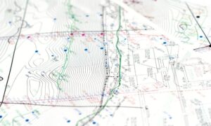
- GIS mapping tools help visualize problem areas
- Drones and LiDAR provide high-detail surveys
- Crash analysis systems identify patterns and high-risk areas
Denver’s engineers rely on this data to justify improvements and secure funding for safer infrastructure.
Partnering with the Community and City Officials
Public input plays a big part in transportation planning. Engineers work with city planners, safety advocates, and residents to ensure the designs reflect real needs. In Denver, this might include:
- Hosting public feedback sessions
- Coordinating with the Vision Zero program
- Evaluating school zones and Safe Routes to School
Community engagement ensures that projects improve safety without ignoring local concerns.
Why Transportation Engineering Matters for Denver’s Future
As Denver grows, more cars, bikes, buses, and pedestrians will use the city’s roads. As the city grows, professional transportation engineers in Denver are essential to building safer roads, reducing congestion, and improving mobility for everyone. Their work not only saves lives—it also:
- Reduces congestion
- Lowers emissions
- Improves accessibility
- Increases the value of public infrastructure
Safer roads support better neighborhoods and a stronger city.
Frequently Asked Questions
1. What do transportation engineers do in Denver?
They plan and improve road systems, traffic signals, and pedestrian areas to make travel safer and more efficient.
2. How do they make roads safer?
By using crash data, engineering tools, and public input to design roadways that reduce accidents and improve traffic flow.
3. Are transportation engineers involved in public transit?
Yes. They help design bus lanes, transit stops, and routes to integrate transit into the city’s transportation network.
4. Can citizens give feedback on road safety projects?
Absolutely. Engineers often rely on community input to shape design decisions, especially for local or neighborhood-level improvements.5. What impact will transportation engineers have on Denver’s growth?
They’ll ensure the road network grows in a way that supports safe, efficient movement while protecting people and the environment.
