Surveying has come a long way from chains and compasses. Today, modern tools help surveyors gather more accurate and detailed data than ever before. One of the most powerful technologies behind this change is LiDAR mapping.
LiDAR, which stands for Light Detection and Ranging, uses laser pulses to create 3D maps of the ground and objects on it. While it may sound technical, this tool is making land surveys faster, smarter, and more useful—especially in places with complex terrain, like Denver, Colorado.
How Surveying Has Evolved Over Time
Traditional surveying relied on tools like measuring tapes, compasses, and total stations. These methods are still used, but they require more time and can sometimes miss small changes in the land’s surface.
With digital tools like drones and LiDAR, surveyors now capture more information in less time. These newer methods allow teams to safely map hard-to-reach areas and deliver better results for projects of all sizes.
What Makes LiDAR Mapping Different
While GPS tools measure points on the ground, LiDAR scans the entire surface. A LiDAR device sends out thousands of laser pulses per second. When those pulses bounce back, a computer calculates how far away each object is—trees, buildings, hills, and even small dips in the ground.
The result is a high-resolution 3D model of the land. This level of detail helps planners and engineers make better decisions before breaking ground.
The Role of LiDAR in Today’s Land Surveys
In many areas, including Colorado’s mountain-edge cities, LiDAR is becoming a go-to tool. It helps surveyors with tasks such as:
- Measuring slope and elevation
- Creating grading plans for construction
- Mapping flood-prone areas
- Locating changes in terrain that affect drainage
When combined with traditional methods, LiDAR improves the accuracy and usefulness of survey data.
Digital Mapping in Action: A Look at Colorado Terrain
Denver and its surrounding areas include everything from flat open spaces to steep hills and rocky soils. These conditions make elevation a major factor in how land can be developed.
That’s why digital elevation and terrain analysis—powered by LiDAR—is so valuable here. It helps surveyors provide clear, detailed maps for builders, city planners, and engineers working on complex sites.
LiDAR and the Push for Smarter Development
Smart growth means planning with the land, not against it. With LiDAR-based topographic mapping, decision-makers can:
- Avoid building in unstable or flood-prone zones
- Protect natural waterways and slopes
- Prepare roadways and infrastructure that match the terrain
In short, LiDAR supports smarter, safer, and more sustainable land use.
Combining LiDAR Mapping with Other Survey Tools
LiDAR isn’t used on its own—it works best when paired with other modern land surveying methods. These include:
- GNSS (GPS-based systems)
- Photogrammetry
- Total stations
- Aerial drone surveys
Surveyors use the right combination of tools depending on the job, the land, and what questions need to be answered.
Where to See LiDAR Mapping in Action
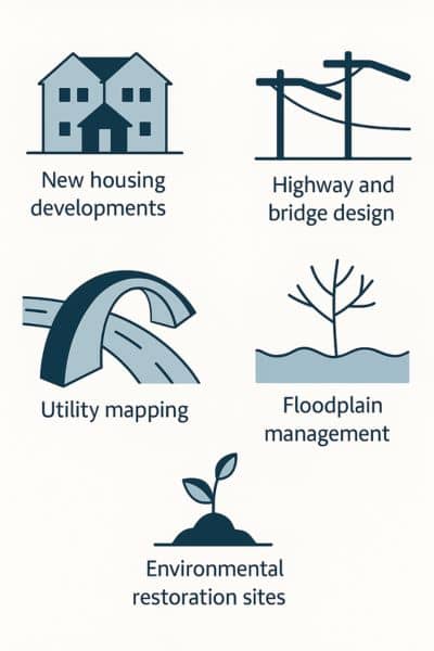
LiDAR is already being used in:

1. New Housing Developments
LiDAR helps surveyors measure elevation changes, identify flood-prone areas, and plan grading—ensuring homes are built on safe, well-prepared ground.
2. Highway and Bridge Design
LiDAR provides detailed surface models and terrain profiles that engineers use to design road alignments, drainage paths, and bridge foundations.
3. Utility Mapping
By capturing ground surface and vegetation, LiDAR helps locate existing infrastructure and plan routes for new utility lines while avoiding conflicts.
4. Floodplain Management
High-resolution elevation data from LiDAR allows agencies to model water flow, define flood zones, and develop more accurate flood risk maps.
5. Environmental Restoration Sites
LiDAR supports restoration by monitoring erosion, vegetation coverage, and terrain changes over time—essential for habitat and watershed recovery.
In many of these cases, advanced surveying tools used in Denver rely on LiDAR to reduce risk and meet strict building codes.
Choosing the Right Surveying Approach
Not every project needs LiDAR—but when elevation, drainage, or surface detail matters, it often makes sense. That’s especially true in areas with changing terrain, like Denver’s hillsides and expanding suburban edges.
Working with a team experienced in LiDAR mapping ensures that you get the data you need—fast, safe, and accurate.
FAQs
1. What is LiDAR mapping?
It’s a technology that uses laser pulses to measure the shape of the ground and nearby features with high accuracy.
2. Why do surveyors use LiDAR?
LiDAR captures detailed surface data, which helps with grading, drainage, and planning—especially in complex landscapes.
3. Is LiDAR better than GPS?
They work best together. GPS gives accurate points, while LiDAR fills in the full surface between those points.
4. Do I need LiDAR for my property survey?
Not always—but if your land has slopes, trees, or drainage concerns, it can provide better results than traditional tools alone.
5. Is LiDAR used in Denver surveys?
Yes. Many surveyors in Denver use LiDAR for elevation studies, planning, and construction layout in challenging terrain.